|
|
Maps:
|
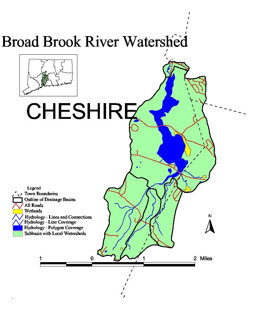
| General
Map- A map of the town boundaries, local drainage
basins, roads, wetlands, and hydrology. |
| Hydrology-
A map of the hydrology, wetlands and outline of the local
watershed. |
| Landuse-
A map of the landuse and the outline of the local
watersheds. |
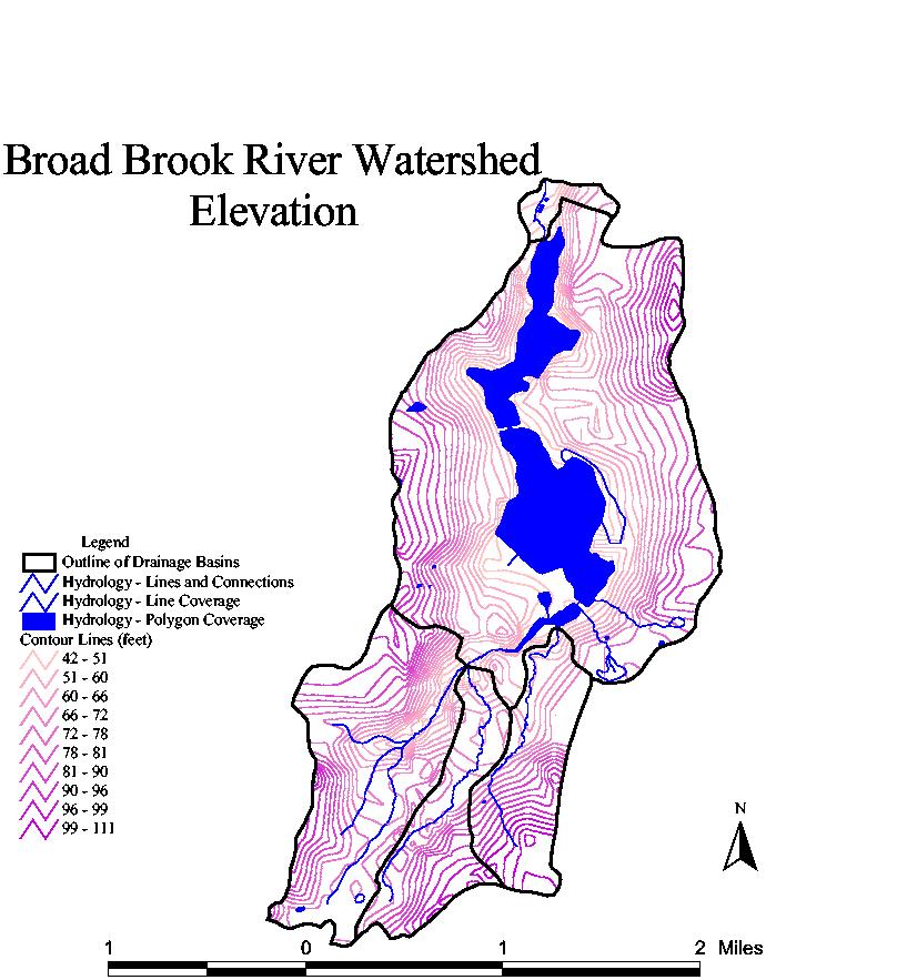
| Elevation-
A map of the elevation, hydrology, wetlands and the local
watersheds. |
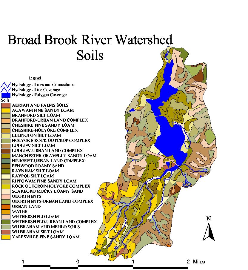
| Soils-
A map of the soils and hydrology. |
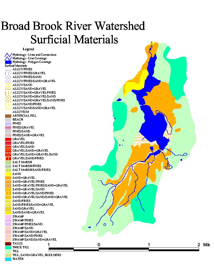
| Surficial
Materials- A map of the surficial materials,
hydrology and the outline of the local watersheds.
|
| 3 D Images-
Many different three dimensional images created with 3D
Analyst. |

