|
|
Maps:
|
| General
Map- A map of the town boundaries, local drainage
basins, roads, wetlands, and hydrology. |
| Hydrology-
A map of the hydrology, wetlands and outline of the local
watershed. |
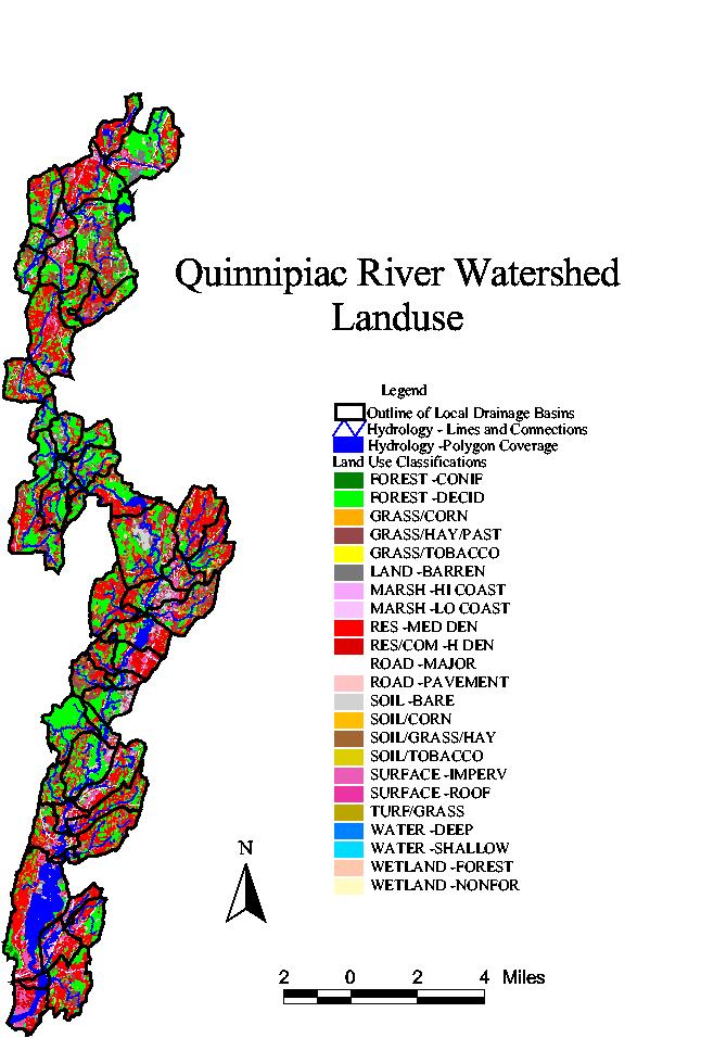
| Landuse-
A map of the landuse and the outline of the local
watersheds. |
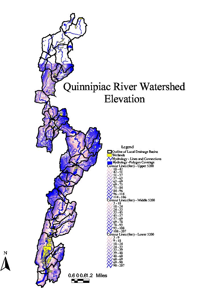
| Elevation-
A map of the elevation, hydrology, wetlands and the local
watersheds. |
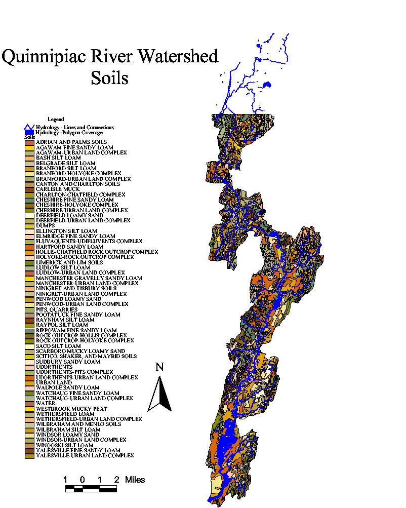
| Soils-
A map of the soils and hydrology. |
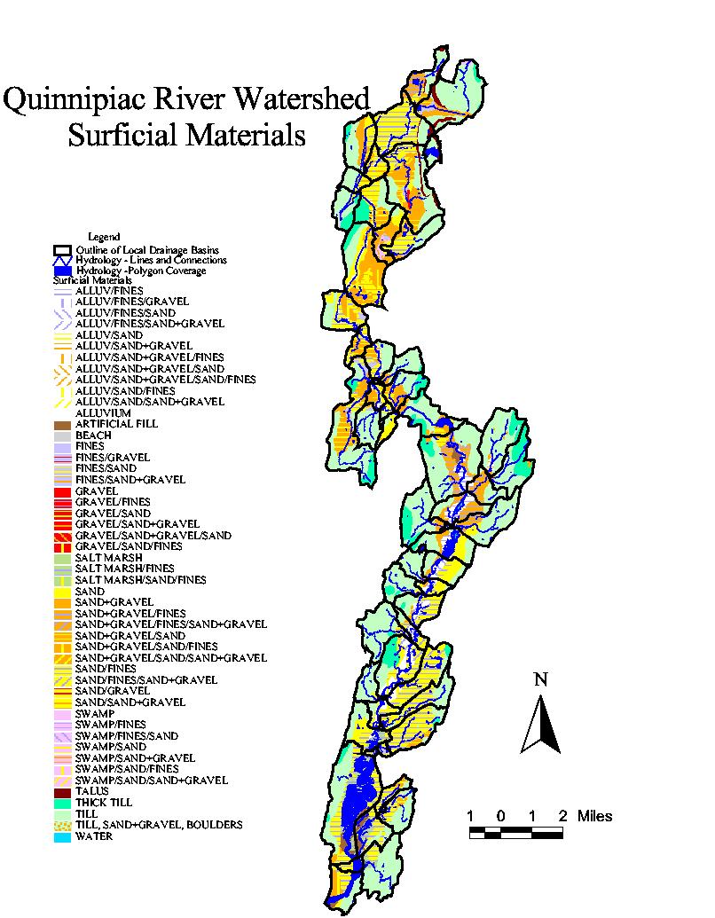
| Surficial
Materials- A map of the surficial materials,
hydrology and the outline of the local watersheds. |
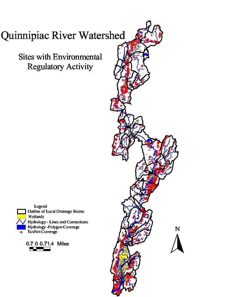
| Sites
with Environmental Regulatory Activity - A map of the
toxnet sites, hydrology, wetlands and the outline of the
local watersheds. |
3D Images
Northern Section
Middle Section
Southern Section
|

